Adventure Series: Wicklow South
€13.10
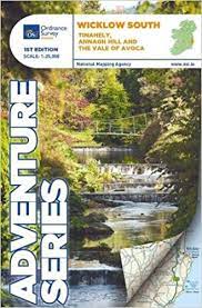
Tinahely, Annagh Hill and The Vale of Avoca. The Adventure Series is an activity oriented map which shows detailed landscape information. It provides detailed mapping in specific locations for the outdoor enthusiast such as mountaineers, hill walkers, cyclists and other users of the Irish countryside.
In stock
Ships in 24h
Across Ireland
Click & Collect
Free in Wicklow
Easy returns
Within 30 days
Secure checkout
Stripe protected
This map is situated in County Wicklow, County Carlow and County Wexford. Roads shown on this map include R752, R753, R747 and R748.
A short portion of the M11 at Arklow is shown. The railway which runs through the Vale of Avoca to Arklow town is shown. Among the towns and villages shown on this map are Avoca, Aughrim, Arklow western section of the town, Hacketstown, Knockananna, Tinahely and Shillelagh.
Mountains and hills that feature are the western part of Croaghanmoira, Cushbawn, Croghan, the southern section of Slieve Maan, Carrickashane, Ballyteige and Stookeen.
Among the rivers on this map are the Ow River, the Aughrim River, the Avoca River, the Derreen River and the Derry River. This map shows the historic site of Avondale House and Forest Park.
The Wicklow Way continues down through the map. Among the many trails, loops and walks marked on this map are Avondale Trails, Avoca Red Kite Trails, Sean Linehan Walk, Ciaran Shannon Walk, Mangans Loop, Ballycumber Loop, Kyle Loop, Tinahely Railway Walk, and Tomnafinnogue.
One Discovery map 1:50,000 sheet 62, also covers this area.
Additional information
| Weight | 201 g |
|---|---|
| Book_author | Ordnance, Survey Ireland |
| Cover | Other |