2025 Philip’s Big Road Atlas Britain and Ireland
€19.18
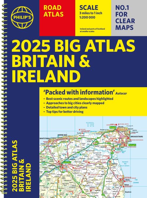
This atlas contains 96 pages of road maps covering Britain at 3 miles to 1 inch (Scottish Highlands and Western Isles at 4 miles to 1 inch, Orkney and Shetland at 5.25 miles to 1 inch). The maps clearly mark service areas, roundabouts and multi-level junctions for easy navigation, and in rural areas distinguish between roads over and under 4 metres wide, to help wide vehicles. There are extra-detailed town plans for easy navigation with all counties marked for clarity. The atlas also includes a 2-page road map of Ireland, route-planning maps, a distance table, and 12 large-scale city approach maps with named arterial roads and the expanded ULEZ clearly outlined for London.
Out of stock
Ships in 24h
Across Ireland
Click & Collect
Free in Wicklow
Easy returns
Within 30 days
Secure checkout
Stripe protected
'Good balance between detail and clarity with excellent town maps' What Car?
PHILIP'S is No. 1 in the UK for clear maps. The latest 2025 Philip's Big Road Atlas of Britain and Ireland, in a supersize large format, has fully updated mapping from the Philip's digital database alongside all the detail and information needed for successful travel.
* Top driving tips for safety and skill including how to parallel park
* The best scenic routes, natural features and landscape highlighted for enhanced travelling
* Practical 'more to view per page' A3 size
* Main scale of maps: 3 miles to 1 inch = 1:200,000 for ease of use
* Route-planning section for the easiest navigation
* Special wide-vehicle access indicators for rural areas
* 64 fully indexed and detailed town and city plans
* City approach maps with named roads for the best access with the latest ULEZ clearly outlined
* Clear road map showing all of Ireland
2025 Philip's Big Road Atlas of Britain and Ireland contains 96 pages of road maps covering Britain at 3 miles to 1 inch (Scottish Highlands and Western Isles at 4 miles to 1 inch, Orkney and Shetland at 5.25 miles to 1 inch). The maps clearly mark service areas, roundabouts and multi-level junctions for easy navigation, and in rural areas distinguish between roads over and under 4 metres wide, to help wide vehicles. There are extra-detailed town plans for easy navigation with all counties marked for clarity. The atlas also includes a 2-page road map of Ireland, route-planning maps, a distance table, and 12 large-scale city approach maps with named arterial roads.
Wherever you are driving in Britain or Ireland, this is the ultimate road companion.
Additional information
| Weight | 940 g |
|---|---|
| Dimensions | 39.2 × 28.8 × 1.2 cm |
| Book_author | Maps, Philip's |
| Publisher | Philip's |
| Imprint | Philip's |
| Cover | Other |
| Pages | 168 |
| Language | English |
| Edition | |
| Dewey | 912.41 (edition:23) |
| Readership | General – Trade / Code: K |